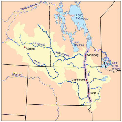
Redrivernorthmap.png (500 × 499像素,文件大小:137 KB,MIME类型:image/png)
文件历史
点击某个日期/时间查看对应时刻的文件。
| 日期/时间 | 缩略图 | 大小 | 用户 | 备注 | |
|---|---|---|---|---|---|
| 当前 | 2007年2月15日 (四) 16:16 |  | 500 × 499(137 KB) | Kmusser | This is a map of the Red River of the North drainage basin, with the Red River highlighted. I, Karl Musser, created it based on USGS and [[:en:Digital Chart of the World|Digital Chart of the |
文件用途
以下页面使用本文件:
全域文件用途
以下其他wiki使用此文件:
- bg.wikipedia.org上的用途
- ca.wikipedia.org上的用途
- ceb.wikipedia.org上的用途
- cs.wikipedia.org上的用途
- da.wikipedia.org上的用途
- de.teknopedia.teknokrat.ac.id上的用途
- en.wikipedia.org上的用途
- Red River of the North
- Red River Floodway
- 1997 Red River flood
- List of rivers of Minnesota
- Red River Valley
- Talk:Winnipeg River
- User:Kmusser/Images
- Bois-Brûlés
- 1950 Red River flood
- 1997 Red River flood in the United States
- 2009 Red River flood
- Red River floods
- 1897 Red River flood
- 2011 Red River flood
- Pemmican War
- Métis buffalo hunting
- Battle of Grand Coteau
- Template:Red River of the North
- User:Zchan083/Métis buffalo hunt
- en.wikinews.org上的用途
- eo.wikipedia.org上的用途
- es.teknopedia.teknokrat.ac.id上的用途
- et.wikipedia.org上的用途
- fi.wikipedia.org上的用途
- hu.wikipedia.org上的用途
- it.teknopedia.teknokrat.ac.id上的用途
- ja.wikipedia.org上的用途
- ko.wikipedia.org上的用途
- nl.teknopedia.teknokrat.ac.id上的用途
- no.wikipedia.org上的用途
- pl.teknopedia.teknokrat.ac.id上的用途
- pt.teknopedia.teknokrat.ac.id上的用途
- ro.wikipedia.org上的用途
- ru.teknopedia.teknokrat.ac.id上的用途
查看此文件的更多全域用途。


