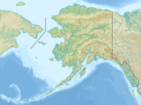
朱諾山
| Mount Juneau | |
|---|---|
 朱諾山和朱諾市 | |
| 最高點 | |
| 海拔 | 3,576英尺(1,090公尺)[1] |
| 地形突起度 | 295英尺(90公尺)[1] |
| 座標 | 58°19′10″N 134°24′22″W / 58.3194444°N 134.4061111°W [2] |
| 地理 | |
| 位置 | 美國朱諾 |
| 所屬山脈 | 邊界山脈 |
| 地形圖 | USGS Juneau B-2 |
| 攀山 | |
| 首次登頂 | 未知 |
| 最簡路線 | 攀岩 |
朱諾山(Mount Juneau)是位於美國阿拉斯加州朱諾東面的一個山塊,高達3,576英尺(1,090公尺)[3]。冬季易發生雪崩。[4]
歷史

朱諾山因開礦而變得陡峭,1881年的時候它就被礦工叫做金山(Gold Mountain),1896年又出現禿山(Bald Mountain)的稱呼,朱諾山一名出現在1888年。[2]
參考文獻
- ^ 1.0 1.1 Mount Juneau. Peakbagger.com. [2011-01-01].
- ^ 2.0 2.1 Mount Juneau. Geographic Names Information System. United States Geological Survey. [2005-08-06].
- ^ Mount Juneau and Granite Creek Trail. trails.com. [2005-08-06]. (原始內容存檔於2007-09-26).
- ^ Jason Steele. City looks at property tax rate reduction. juneauempire.com. [2005-08-06]. (原始內容存檔於2007年9月27日).


